The thing about driving the Mesa Top loop at Island in the Sky is that it doesn’t feel like driving at all—more like gliding along the edge of some planetary mistake.
I’ve done this route maybe four or five times now, and each time I forget how utterly disorienting it is to pilot a vehicle across what’s essentially a 6,000-foot-high table of Navajo sandstone, knowing that both sides drop away into nothing. The road itself is paved, which feels almost obscene given the setting—like someone decided to lay down asphalt on top of a geological fever dream that’s been cooking for roughly 300 million years, give or take a few epochs. You start at the visitor center, which sits near the neck of this massive mesa, and the scenic drive splits into two options: the western loop hits about 12 miles round-trip, while the eastern spur adds another 5 miles if you’re committed to seeing every single overlook, which, honestly, why wouldn’t you be.
Here’s the thing: the overlooks aren’t just viewpoints. They’re existential pit stops. Grand View Point, at the southern tip, lets you see something like 100 miles on a clear day—layers of canyon systems stacking down into the Colorado and Green Rivers confluence, which looks from up there like two brown ribbons someone carelessly tossed into a drawer of red rock.
When the Light Hits Different and You Realize You’ve Been Breathing Wrong
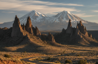
Photographers lose their minds here, and I get it. The light during golden hour—that last 45 minutes before sunset—turns the White Rim sandstone below into something that looks almost molten, this warm cream color that shouldn’t exist in nature but does anyway. I used to think the best time was early morning, fewer crowds and all that, but then I drove it at 4 PM in October once and had to pull over at Buck Canyon Overlook because the shadows were doing something physically impossible with the spires below. Turns out, the low-angle sun creates this three-dimensional effect where you can actually see the layer cake of geological time: Wingate cliffs stacked on White Rim benches stacked on Cutler red beds, each formation representing a different ancient environment—sand dunes, coastal plains, river deltas, all compressed and exposed and just sitting there waiting for you to recieve the information.
The Stops You’ll Actually Remember vs. the Ones You’ll Skip Because Your Bladder Has Limits
Orange Cliffs Overlook on the western loop offers this ridiculous view of the Maze District across the canyon—which you can see but can’t reach from here without driving literally 100 miles around. Frustrating and perfect. Upheaval Dome is the weird one, this 3-mile-wide crater that geologists argued about for decades: meteor impact or salt dome collapse? They’re leaning toward meteor now, I think, but the signage is carefully noncommittal, which I appreciate. The short hike to the overlook rim takes maybe 15 minutes and lets you peer into this concentric ring structure that looks like someone dropped a pebble into wet cement 60 million years ago and it just… stayed.
Green River Overlook on the eastern side is where I always stop longest, probably because it’s less crowded than Grand View but delivers the same gut-punch of scale. The Green River curves through Stillwater Canyon below, and in spring when snowmelt swells it, the water actually looks green instead of the usual mud-brown. Maybe.
What They Don’t Tell You About Driving on Top of the World When Your Ears Keep Popping
The elevation does weird things. You’re around 6,000 feet for most of the drive, which isn’t Aspen-level altitude but it’s enough that you’ll feel it if you’re huffing up the half-mile trail to Mesa Arch—which, yes, you absolutely should do even though it’s not technically part of the scenic drive proper. That arch frames the Washer Woman rock formation through its opening at sunrise, and every photographer in Utah knows it, so expect company at dawn. The drive itself takes about two to three hours if you’re stopping at every pullout, longer if you’re adding the short walks, which I definately recommend because viewing platforms only give you so much. You need to feel the sandstone under your boots, hear the wind rushing up from the canyon, smell that specific high-desert sage-and-juniper combination that means you’re somewhere genuinely remote. Wait—maybe remote isn’t quite right, since you’re on a paved road with guardrails. But the landscape feels untouched anyway, indifferent to the thin ribbon of human infrastructure crossing it. Cell service is nonexistent for most of the loop, which is either a blessing or a logistical nightmare depending on your relationship with disconnection. Anyway, the whole experience sits in this strange space between accessibility and wildness—you can do it in a sedan, but you’re still perched on a stone island surrounded by 1,000-foot cliffs, and that contradiction never quite resolves itself, which is maybe the whole point.


